What would the world be, once bereft
Of wet and of wildness? Let them be left,
O let them be left, wildness and wet;
Long live the weeds and the wilderness yet.
-- Greard Manley Hopkins
 N.B. click images to view full size - Click "back" to return to text
In late July of 2009, in ground undisturbed since the last Ice Age, Southwest Community Woodlands , with the help of a large digger created a 'loop',
drawing water from the main burn through a series of channels, pools and cascades and eventually
returning to the burn via shallow wetland margins. The concept was
sketched out by Robin Ade after Ed had done some exploratory digging.
Beavers at Work
For years I had wanted to dig a hole in what I reckoned was glacial rubble underlying the meadow to see what it actually looked like, whether there was clay, and whether we'd hit the granite underneath. 
 In 2008 Godfrey arranged the loan of a wee digger from Roddy Sale, and I had the opportunity to have a go. I found the lower areas roughly stratified, with about 30cm of topsoil overlaying a layer of largish sharp stones and gravel in sandy clay, and below that occasional very large stones and finer clay. There was also water from a small spring fed by runoff from part of Potterland Hill.
A year later, in 2009, fellow trustees decided we could afford to get in a bigger digger and 'create a pond'.  Robin Ade drew up a rough plan for a 'loop' diversion of the main burn, quotes were sought, and the job commissioned. Robin and I between us 'supervised' the excavations,
  pointing this way and that, but the digger operator was very skilled and seemed to enjoy not having to work to a tightly pre-conceived plan. Four days later we had a whole lot of channels and pools, two potential sand martin banks, and lots of bare spoil and some nice larger stones uncovered in the digging...
There was Robin's drawing which guided the digger work, but beyond that there wasn't really much of a plan,  nor at least in my mind, any recognition that we were taking on a responsibility to maintain and control the system. A fortnight after the digger work was finished, in mid-August
  we had heavy rain and witnessed the first spate in the new diggings, and realised we needed to drain the overflow from behind the big bank, which was washing down the side of the big pond. Robin and Simon and I dug a channel and created a waterfall into the pond which has since eroded into a sort of cascade and only flows when there has been considerable rainfall - the 'normal’ flow into the area behind the bank makes its way into the pond through a 'spring' under the bank. Robin also got us started using large stones to make small damlets/weirs to pool up the wider areas of the inlet channel and at the outlet of the large pond and the next pool down.
I began paying attention to the inlet from the main burn,  feeling that we should limit our out-take to around a third of the burn's flow so as not to harm the stretch between out-take and return. I put a 7-inch ceramic pipe at the base of the inlet to make sure of flow
  in lowest water conditions and arranged an inlet gap in the (inlet dam) pile of stones. Of course, in spate conditions the burn flow overwhelmed the inlet dam and the new works experienced its share of the spate. At other times leaves and sticks clogged both gap and pipe and needed to be manually cleared.
A long process of system evolution began.
Over the years I have added a second gap in the upstream side of the inlet dam and widened and deepened the main gap.  The pipe is well buried and probably not giving much flow by now, and the 'inlet dam' has become a sort of triangular island with inflow on both sides. These channels and the channels either side of the stepping stone sometimes need clearing of gravel. It is impressive how much gravel has arrived down the years - several tonnes for sure. This gravel has been very useful for backing/reinforcing dams and stemming leaks. It may also in places provide spawning opportunities for trout.
Robin started all the dam-building by raising the big pond's outlet level a bit in June 2010.  In July 2011 we raised a dam at the inlet to the big pond, raising the water behind it by about 16 inches and providing for fall and aeration of the
  inflowing water. The dam used large stones, and its very shallow arch required strong end-points. It is laid on the large flattish boulder originally left in place by the digger, which now serves as a step for easily entering the water.
  It was well-pinned in drystane dyke style and backed by a layer of clay mixed with sharp gravel, followed by earth and turfs, etc. at first, but proved quite leaky. Subsequently a considerable amount of the accumulated gravel has been used to back it all up, and it no longer leaks noticeably. Gravel has proved far more effective in stopping leakage than soil, turfs, etc.
 Ever since boyhood, I have built dams in streams, and almost always if revisiting them, found them washed away. I was in my sixties before I realised why 'proper' dams are always built in an arch with the convex side facing upstream... Us boys, even when grown big, seem to somehow want to make a pool with a circular shape, but if a dam faces downstream - even just a little bit, downstream it is sure to go.
In July 2014 we raised and reinforced the dam at the outlet of the big pond by a good bit, using large stones from the roadside dyke, backing it with clay, some old canvas, and considerable gravel. More
  stone & gravel was added in 2016 & 2017, and this has raised the level of the pond at overflow considerably. As a result, the fall at the inlet is only a few inches – it varies depending on overall flows, but still provides considerable aeriation, as do the falls between the pools upstream of it.
A persistent leak in the main earthen dam between the infall and outfall has received a good deal of canvas, clay and gravel over several years, and may need more over time. This leak probably has its origins in topsoil buried by my initial diggings, which then became part of the main earthworks done by the bigger digger.... it emerges at the upper end of the next pool down, and continues to flow. The earthen dam also leaks into the willow area below it on the other side of the outlet, probably due to more buried topsoil. No doubt both leaks are increased by raised hydrostatic pressure due to the higher level of the pond, which is now at the upper limit of the main earthen dam.

 In 2017, Sean Clayton and I constructed a simple plank footbridge across the big pond's outlet and a small channel has been dug along part of the top of the earthen dam to divert overflow back to the outlet and make the path less prone to bogginess. We also set some flat stepping stones in persistent wet spots at the burn system inlet and near the totem pole.
Faced with a record dry Spring, I raised the weir in the main burn slightly to divert more flow into the new works and shifted some more of the accumulated gravel to the upstream (back sides) of the damlets for the pools in the inlet channel.  The diversion is now taking between one half and two thirds of the burn's flow, but never all, and coupled with some other leakage repairs, the large pond has been full to overflowing all through the record dry spell.
Also in 2017, Sean and I buried a section of large drainage pipe in the 'still pond' inlet,  which should ensure flow even in lowest water conditions and will increase circulation.
  I also built another dam and did some other work just down from the big pond outfall to create a pool and cascade, reducing the obstacle to upstream fish migration. This involved more stone from the roadside dyke (mostly from tree-tumbled sections) and lots of gravel. It is doing its job well, and I hope to be lucky enough to see fish coming up it sometime.
I little thought I would turn into such a beaver,  but has been a wonderful eight years playing with stone and water to spread and hold the wetness on the land as long as possible - watching the recovery and development in the flora and fauna in a range of ecological niches from swift, shallow pools and channels, through to a deepish pond with good circulation, a still, but not stagnant, shallow pond, and soggy, waterloged wetland -- A complex mixture of Natural systems with a gentle element of artifice.
  We have also put in plenty of willow cuttings and transplanted a few of the self-sown young alders - spreading the already-present native varieties around the lower area made wetter by the diverted water. Hopefully, when re-introduced beavers eventually arrive at Taliesin, as they surely will, they will find plenty of raw material to work with.
Geological and Hydrological Context
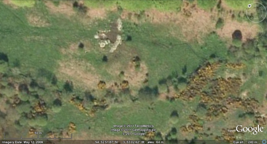
Screel and Potterland hills are both composed of the Older Silurian rock (pale background in image) which dominates Galloway. These hills were pushed up by the granitic intrusion which extends from Bengairn to Criffel. Immediately to the South of these hills, the granite appears as outcrops which can be observed in the fields on the lower slopes of Screel, and the coastal peninsular landforms surrounding Auchencairn bay. Taliesin straddles part of the space between these two hills.
  It appears to be largely composed of glacial rubble carried down by the ice and meltwater and deposited where the valley narrows and may contain a rock dam virtually bridging the gap. The ice was probably a mile thick at the peak of the last glaciation, and without doubt the present meadow areas were continuously flowing with meltwater as the ice retreated some ten thousand years or so ago. Potterland burn now passes down through it, joined by tributaries from the hillsides, and carries all the drainage/runoff from the catchment. Because of the relatively small area of the catchment (less than 1000 acres), water levels and flow vary considerably depending upon recent rainfall.
Within the site, tributaries to the main burn include the "upper burn" which drains part of Screelside and enters Taliesin from Whitehill Farm,  the flush which includes the spring behind the cabins and passes through the upper pond (created in the mid 1990s), and another flush about midway along the Southwest edge of the site - all join the main burn at points along its course. Old maps show that part of the burn was once diverted along the contour to feed a millpond in the next compartment. From the straightness of the burn to this out-take, it may be inferred that it was artificially straightened for the purpose, and the line showing the previous diversion continues straight for a stretch.
The inlet is arranged in such a way that, even at lowest flow levels, water is divided between the new diggings and the original course of the main burn In full spates, the burn overflows the inlet dam, so that water  flows in the new works vary with conditions, mimicking a natural system. The inlet channel then cascades down through several pools to a dam over which it falls a few inches
  into the main pond.
Fish are seen leaping/feeding regularly in the evenings since the Summer of 2011. Looking down the the main pond (left) from atop the sand martin bank toward the outlet cascades, a medium pool and shallow burnlet which lead to the
into the main pond.
Fish are seen leaping/feeding regularly in the evenings since the Summer of 2011. Looking down the the main pond (left) from atop the sand martin bank toward the outlet cascades, a medium pool and shallow burnlet which lead to the  lower ponds as seen from the bank outside the roadside beeches, with fourteen year old
ashes and oaks in the foreground (pictured right), spreading wetland (to the left) and the shallow side inlet to the still pond on the right.
lower ponds as seen from the bank outside the roadside beeches, with fourteen year old
ashes and oaks in the foreground (pictured right), spreading wetland (to the left) and the shallow side inlet to the still pond on the right.  The still pond is connected to the main flow only via a shallow inlet, and thus has relatively little exchange of water, and was already (December 2011) showing considerable rooted plant life. Fish (confirmed to be native brown trout) have been seen since early Summer 2011.
The flow then spreads out into a wet area dominated by hemlock, watercress, meadowsweet, valerian, marsh woundwort, watermint, etc., willows and alder,
returning eventually to the main burn by diverse channels.
The still pond is connected to the main flow only via a shallow inlet, and thus has relatively little exchange of water, and was already (December 2011) showing considerable rooted plant life. Fish (confirmed to be native brown trout) have been seen since early Summer 2011.
The flow then spreads out into a wet area dominated by hemlock, watercress, meadowsweet, valerian, marsh woundwort, watermint, etc., willows and alder,
returning eventually to the main burn by diverse channels.
(View ~ESE from the sand martin bank above the still pond.)
Comments on Further Development and Management
Inlet and flow control
The inlet from the main burn occasionally gets obstructed
with leaves and rubbish and rewards a poke-through with a
walking stick
The weir seems about right, but relatively fine adjustment is possible by adding or removing selected stones
Levels
Levels of the dam pool and main pond have been raised as much as
practical and the dams reinforced.
The pool between the main pond and the still pond might be raised
if it were thought desirable.
Dam pool
The dam overflowing into the main pond was originally backed up with
clay, turfs, and other vegetation, but gravel has subsequently proved far more effective.
From time to time it also has an accumulation of watercress torn loose and carried down in spates. A willow cutting put in at the south end of the dam has taken.
The area on the North side of the dam pool serves as an overflow/seepage area and
will probably remain semi-permanently damp with appropriate vegetation.
Sand martin banks
The turf and other vegetation along the tops of the banks beside the main pond and still pond have now consolidated sufficiently for consideration to be given to cutting them steeper and possibly providing some pilot holes to encourage sand martin colonisation - a future project/work-party if anyone is interested.
Wildlife
Water boatmen, Caddis flies, butterfflies, dragonflies, damselflies, hoverflies, tadpoles, frogs and toads, dippers and other birdlife, deer, trout, sticklebacks, tiny shrimps and diving beetles have all been noted. Goldfish have been put in the main pond a couple of times, but they don't evade the notice of herons for long.
Vegetation
Only Ox-eye daisies and watercress have been imported, the rest of the emergent and submerged vegetation being locally native species from the persistent seed bank. Pondweed (Potamogeton natans), water crowsfoot, starworts, duckweeds, sharp-flowered rush (in the 'still pond')and other aquatic plants are thriving, The water hemlock could possibly be minimised and controlled in the new waterways, but extermination in the original watercourses would be impracticable.
The watercress has shown a rather invasive character, and may (or may not)
need controlling at some future time.
There are two osiers between the original burn and the still pond from cuttings stuck in some years back. They should perhaps be pollarded or even removed entirely, and nearby, originating from a discarded raft, there's a patch of willow in the edge of the still pond...The sunken raft provides shelter for fish, etc. and is probably a mass of rootlets underneath. Willow can live, but doesn't thrive with its roots permanently in water, and this bit is illustrative.
Various fruit trees and some oak, hazel and hawthorn have been planted in appropriate places, including oaks on the back of the large sand martin bank and on the high ground contained inside the new loop. The level of flow into the lower reaches has been raised a bit so that the lower area of knotweed is much wetter, and more willow cuttings around the lower edge of the knotweed area should help to surround and contain it. Some of the numerous beech seedlings to be found under the roadside beeches have been planted into the knotweed patch, hoping to eventually shade it out and seem to be doing well, but only time will tell. Meanwhile, attention is being paid to the edges of the knotweed to ensure it doesn't spread any more, particularly into the burn.
Although not strictly a local native, beech is already present in that corner,  and a few more won't do any harm, especially if they actually beat the knotweed.
The meadow area above the pondworks between the burn and the road should be monitored to ensure that bracken and hemlock don't spread into the meadowsweet/valerian/etc. areas (I think Sean and the new strimmer have this in mind already). The wetter parts of the area are now showing marsh woundwort gaining ground.
and a few more won't do any harm, especially if they actually beat the knotweed.
The meadow area above the pondworks between the burn and the road should be monitored to ensure that bracken and hemlock don't spread into the meadowsweet/valerian/etc. areas (I think Sean and the new strimmer have this in mind already). The wetter parts of the area are now showing marsh woundwort gaining ground.
Pathways and access
 Pathways can kept relatively clear by strimming once
  annually in July and by foot traffic. They were strimmed for a couple of years following the digger work, but then not again until 2017, when Sean opened them all up again.
Thanks to Sean, the path along the main burn downstream leading towards the still pond is now open and worn by foot and deer traffic. Access is also possible from under the roadside beeches.
annually in July and by foot traffic. They were strimmed for a couple of years following the digger work, but then not again until 2017, when Sean opened them all up again.
Thanks to Sean, the path along the main burn downstream leading towards the still pond is now open and worn by foot and deer traffic. Access is also possible from under the roadside beeches.
Notes:
1. This is an update of the previous web page of the same name - updated October 6th, 2017
2. All images are clickable to view a larger version ("Back" to return to text)
3. Further context for Taliesin and the History of it
becoming our Community Woodland Centre.
Return to North Glen
or Reading List
or Credo

