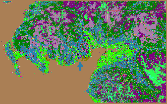
The Stewartry of Kirkcudbright comprises roughly the catchment of three rivers, the Fleet, Dee & Urr, near the foot of which North Glen is situated.

The rivers are all navigable, though none of them large, serving seaports at Gatehouse of Fleet, Kirkcudbright, and Palnackie.

The port at Dalbeattie, upriver from Palnackie, is now largely disused, but loaded many shipments of granite bound for the Thames embankment.

The Urr is easternmost and the smallest of the three rivers, perhaps no more than 70 kilometers from source to the Solway Firth, into which all the Stewartry drains, thence to the Irish Sea, north of the Isle of Man.

Aside from the sea, the area is bounded by uplands, which are more passable near the coast. The whole of Galloway has a tradition of independence, having loosely allied itself at various times with Ireland, Northumbria, as well as with Scotland.
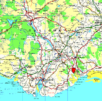
The stewartry of Kirkcudbright (36k)
Galloway and the Solway Firth, bounded on the southeast by the English lake District (29k)
It is at present the most heavily forested part of Great Britain. The Stewartry is roughly one third forested. In the Stewartry, land owned by the Secretary of State for Scotland, through the Forestry Commission, constitutes
one quarter of the total land area. Agricultural and woodland products have probably been staples of coastal trade as long as humans have lived in the area.

We are said by centralist well-wishers to suffer from peripherality, and this is some truth in this economically.
Many jealously guard our backwater 'boondocks' status, hoping only to have more capacity to utilise our natural resources according to local priorities. 140,000 acres of public land would make a nice start.

We are often cautioned that we must live in the 'real world' by folk who mean 'money', a concept
more abstract than theoretical physics.
visitors since Jan 8th 1999